Maps are fascinating.
I was excited to get the question : How do you use maps in your home? from MaryAnne and our cross blog conversation. (See the bottom of this post for more information)
It’s never too young to start looking at a map together and just getting to know what’s there. We’re big fans of maps and include them in everyday things. Today we did an activity using maps.
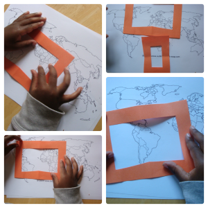
We spent a good time just talking about the map. I started with the general question what can you see? It’s a fascinating opening question to see the baseline. The LO pointed out quite a few things. We have a US, World and Flag place mats in our rotation of place mats so he’s likely picked up information then as we’ve talked about places at dinner. It’s an easy way to map play and develop global knowledge.
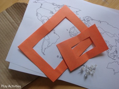
Today we were focusing on the sizes: big and little using frames. The LO moved the frames around the map.
Keeping activities fun
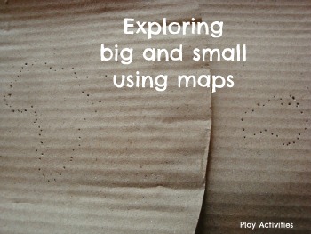
I’d seen an activity about Pin punching around Africa. It looked like a really exciting way to combine a few things we’ve been working on. I loved the idea of the opportunity for focus, concentration. Plus, how exciting is it for a little boy to be using a pin and being able to poke!
My son is favouring his left hand and the added bonus of the fine motor skills, strength and persistence mean that this would be an exciting way to explore the idea of big and little.
We gathered together our materials and set about finding a small place and a large place on the map. I did mention that Africa was a continent and not a country. Having a political map helped with that as he could see the other lines of the countries. He also tried to pin down those lines, when he was distracted.
The spontaneous conversation with Australia was there too. He was quick to point out no lines and how it was fat but small. So he was able to compare the different sizes of land mass. I love the conversations that happen while we’re playing together.
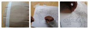
Being a sensory seeker- the LO was keen to touchwhat he was doing. So he traced the map with his fingers first and was keen to do again on the other side where it was bumpy, quite a few times.
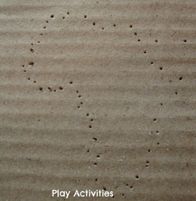
We started with Africa and worked together taking turns to pin around the land mass. We didn’t get all of Africa and didn’t follow it perfectly.
We did the big reveal at the end. He was impressed and was quick to compare both the new dotted map and the original map. He was very excited for me to set up Australia and keen to do it all alone.
He totally loved this activity and while I was making tea set himself up on the table to do another country. He was happy telling his older brothers about big and little places.

Cross blog conversation
I’m having a cross blog conversation with Mama Smiles about bringing global local to our homes without going anywhere. Plus integrating global ideas into our everyday interactions without it being a festival or special day.
A cross blog conversation involves two or more bloggers engaged in a back-and-forth dialogue across a series of blog posts. The goal is to ask – and answer – thought-provoking questions in order to share useful information with our readers.
Our first question: What global games do you play or have influenced you? My response :: Mama Smiles
Our Second question: How do you use maps in your home?
Come back and tell us what you do with maps. In the meantime, pop on over to Mama Smiles where MaryAnne will answer the question: How do you use maps in your home?




My kids will really enjoy this activity – thank you for the inspiration!
I love your variation of this activity! Makes me want to do it again!
We had such a lovely time. I think he liked hearing the sounds with the cardboard too.